Subject: Southern United States, Civil War
Period: 1864 (dated)
Publication:
Color: Hand Color
Size:
41.1 x 29.7 inches
104.4 x 75.4 cm
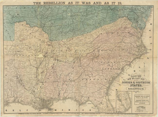
One of a series of detailed, large-format maps published approximately yearly by H. H. Lloyd & Co. under the same title, but showing the progress of the conflict. Those regions shaded in yellow identify areas gained from the rebels; in this case, since January 1, 1862 to February 1, 1864. Areas still held by the Confederacy are shown in red, while territory belonging to the Union is shown in green. Important battlefield sites are marked with red lines and strategic places are marked with red dots. At this stage of the war, the territory lost by the rebels included most of Tennessee, northern Virginia, southern Kentucky, southern Missouri, most of the lower Mississippi River valley, southern Florida, and coastal areas of the eastern seaboard and Gulf of Mexico. Includes an additional title in the top margin "The Rebellion As It Was and As It Is."
References: cf. Stephenson #38.
Condition: C+
Issued folding and now flattened and professionally backed with tissue to reinforce and repair numerous chips, tears, and separations mainly along the fold lines. There are areas of related loss along the fold lines, most notably to the west of Memphis and along the North Carolina border with Georgia and South Carolina. Light soiling.