Subject: Colonial Southern United States
Period: 1780 (circa)
Publication: L'Histoire Philosophique et Politique…
Color: Hand Color
Size:
8.4 x 12.8 inches
21.3 x 32.5 cm
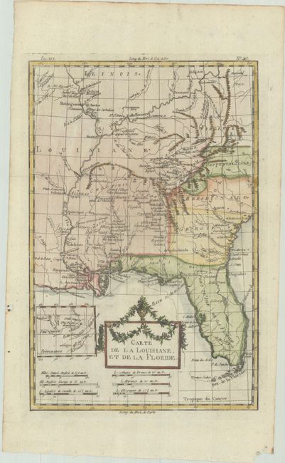
This is the more decorative version of this interesting map of the American south and the Mississippi River Valley. The map extends from Charleston, South Carolina west to include New Orleans and north into Illinois. In this French-produced map Louisiana extends to the Appalachian Mountains bordering the southern colonies. The Mississippi and Ohio Rivers are well delineated. Florida is shown with its panhandle extending west to include Mobile and Biloxi. Locates Charles Town, Savannah, St. Augustine, Mobile, Pensacola, and several far western settlements and forts in the frontier. A small inset provides details of the Missouri River. The title cartouche is topped bedecked with an urn and garlands.
Rigobert Bonne was an important French cartographer of the late 18th century. In 1773 he succeeded Jacques Bellin as the royal cartographer in the Office of the Hydrographer at the Depot de la Marine. Working in his official capacity, Bonne compiled some of the most detailed and accurate maps of the period.
References: Sellers & Van Ee #1401.
Condition: A
A crisp impression, issued folding on a bright sheet with a few small chips along the edges of the sheet.