Subject: Colonial Southeastern United States
Period: 1642 (circa)
Publication:
Color: Hand Color
Size:
20 x 15.3 inches
50.8 x 38.9 cm
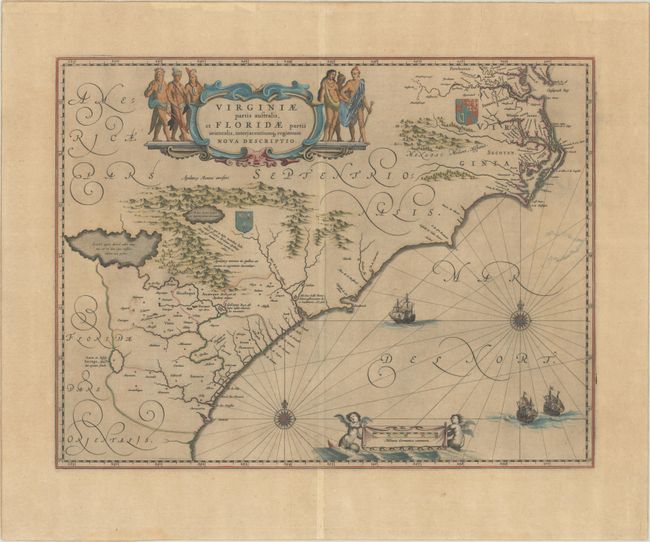
This lovely map of the Southeast extends from the southern part of Chesapeake Bay to northern Florida. Cartographically it improves on the Hondius map of 1606, on which it was derived, with the Chesapeake Bay correctly indicated as a large bay and the Carolinas and Georgian coasts depicted more accurately. The map presents the English and French colonial interests in the region as depicted by their respective royal arms. At the southern end of the Appalachians is a note concerning gold and silver mines. Richly decorated with a large cartouche flanked by Native Americans. The Atlantic Ocean contains two compass roses, three sailing ships and two aquatic putti holding the German scale of miles. This is the second state of the map with Dutch text on verso, published between 1642-64.
References: Burden #253; Van der Krogt (Vol. II) #9400:2.
Condition: B+
A dark impression on a lightly toned sheet with one tiny hole along the centerfold only visible when held to light. There is an archivally repaired chip and short repaired edge tear both confined to the bottom blank margin.