Subject: Maryland & Delaware
Period: 1796 (circa)
Publication: The American Universal Geography
Color: Black & White
Size:
9.6 x 7.5 inches
24.4 x 19.1 cm
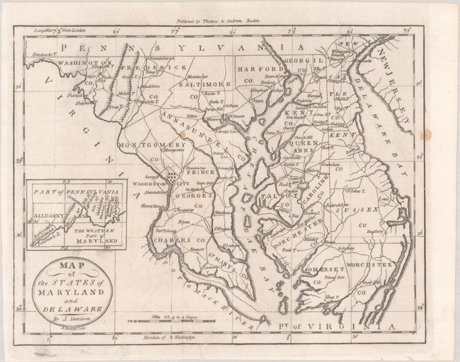
This is the first state of this detailed map that includes all of the Chesapeake Bay and locates Washington City. At left is an inset, The Western Part of Maryland, that names the Potomack River and several mountain ridges. Counties are named and delineated. The map also shows towns, roads, topography, and good watershed detail. Drawn by James Denison, engraved by Amos Doolittle, and published by Thomas & Andrews, Boston.
References: McCorkle (18th C. Geography Books) #304-10; Wheat & Brun #514.
Condition: B+
Issued folding and now flattened and backed with tissue to repair a long separation and related tear at bottom. There are a couple of light spots and a bit of printer's ink residue.