Subject: Colonial Mid-Atlantic United States
Period: 1780 (published)
Publication: Universal Magazine
Color: Black & White
Size:
13.1 x 11 inches
33.3 x 27.9 cm
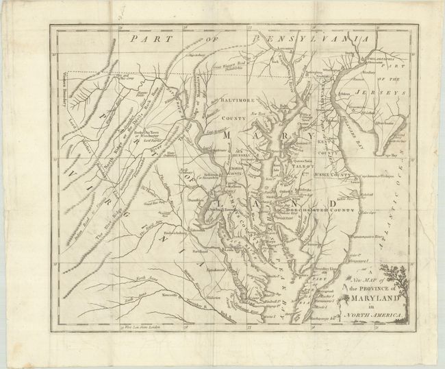
This copper engraved map was issued during the Revolutionary War. It covers the Chesapeake Bay region with good detail of settlements and roads, including the "Indian Road to Virginia" and the "Great Waggon Road to Philadelphia." Locates Fredericksburg, Charles Town, Oxford, Philadelphia, and Annapolis. Delaware is labeled "Newcastle C. Part of the Jerseys". The Western Boundary and Lord Fairfax's Boundary Lines are delineated. On the eastern shore, the Boundary Line of 1688 is noted between Maryland and Virginia adjacent to Watkin's Point. There is a decorative title cartouche at bottom right.
References: Jolly #UNIV-184; Sellers and Van Ee #1412; Phillips (Maps) p. 394
Condition: B+
Issued folding on watermarked paper with light creasing around the fold lines, faint offsetting, and an archivally repaired 2" edge tear at right.