Subject: New England & Mid-Atlantic United States
Period: 1783 (circa)
Publication: Atlas de Toutes les Parties Connues du Globe Terrestre
Color: Hand Color
Size:
12.6 x 8.3 inches
32 x 21.1 cm
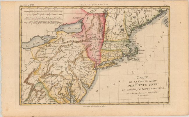
This very early map presents the northern part of the newly-formed United States. It covers the region from northern Virginia to Maine (Machasuzet Bay), and westward to include Lake Erie. The map has good topographical detail, and it also includes numerous settlements, forts, and Indian villages. It locates Baltimore, Annapolis, Alexandria, New York, Boston, Ft. Halifax, and much more. There are four distance scales at upper left.
Rigobert Bonne was an important French cartographer of the late 18th century. In 1773 he succeeded Jacques Bellin as the royal cartographer in the office of the Hydrographer at the Depot de la Marine. Working in his official capacity, Bonne compiled some of the most detailed and accurate maps of the period.
References: McCorkle #782.1B; Sellers & van Ee #744.
Condition: B+
A crisp impression on a sturdy sheet with light toning.