Current Auction
Lot 131
Current Auction

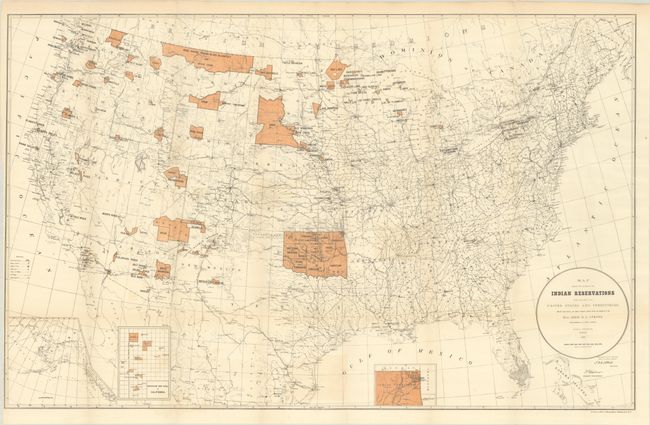
"Map Showing the Location of the Indian Reservations Within the Limits of the United States and Territories...", U.S. Bureau of Indian Affairs

Subject: United States

Period: 1887 (dated)

Publication:

Color: Printed Color

Size:
33.4 x 21.1 inches
84.8 x 53.6 cm
Download High Resolution Image
(or just click on image to launch the Zoom viewer)

This large map of the United States focuses on the many Indian Reservations in the United States as of 1887. The reservations are named and shown in orange overprinting. The map also shows military stations, towns and villages, railroads, and Indian agencies. It includes insets of Alaska, Indian Territory, and Mission Indian Reservation in California at bottom. Compiled under the direction of John Atkins, Commissioner of Indian Affairs. Drawn by Paul Brodie.

References:

Condition: B+

Issued folding with faint toning and color offsetting.

Estimate: $160 - $190

Current High Bid:
$0

Reserve: Reserve Not Met
Next Bid: $80

Bid Increments
$50 - $99$5
$100 - $249$10
$250 - $499$25
$500 - $999$50
Terms & Conditions