Subject: World
Period: 1677 (circa)
Publication:
Color: Hand Color
Size:
18.6 x 12.1 inches
47.2 x 30.7 cm
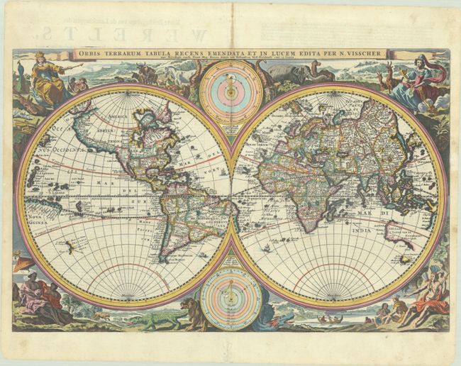
This superb double hemisphere world map is surrounded by engravings including allegorical representations of the continents as well as native inhabitants and wildlife. Visscher's decorations were so popular several other cartographers copied them. Two diagrams depicting the Ptolemaic and Copernican theories of the solar system appear within the cusps of the hemispheres. The northwest coast of North America is greatly exaggerated with the fictional El Streto d'Anian, while California is shown as a peninsula. In the Pacific, Western Australia, Van Diemens Landt, and a bit of New Zealand are also noted. This is the second state with the addition of the Privilege below the title. Dutch text on verso.
References: Poortman & Augusteijn #118; Shirley #431.
Condition: B+
A dark impression on a bright sheet with professional repairs to some tiny worm holes along the centerfold. There is light toning along the centerfold in the top margin, a bit of marginal soiling, and small remnants of hinge tape on verso.