Subject: Colonial Eastern North America & West Indies
Period: 1747 (published)
Publication: A Complete System of Geography...
Color: Black & White
Size:
17.3 x 14 inches
43.9 x 35.6 cm
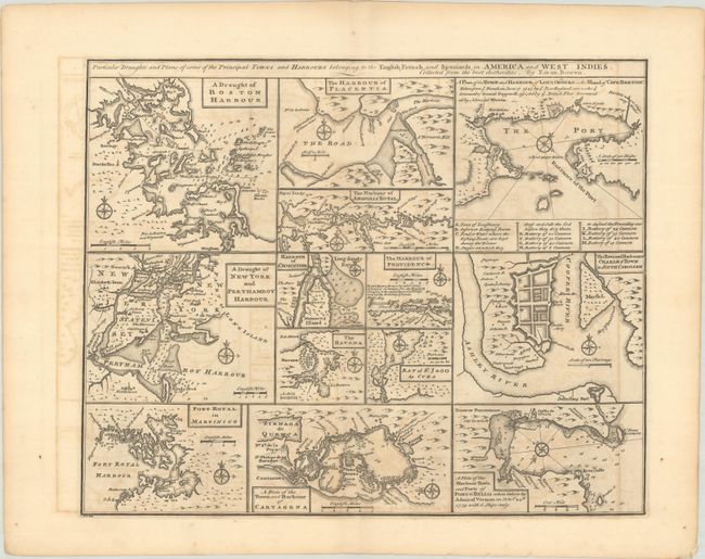
An unusual copper engraving featuring thirteen small maps of colonial towns and sea ports including New York, Boston, Charleston, Cartagena, Martinico, St. Augustine, Havana, etc. Each map includes its own compass rose and scale of miles, and most focus on the waterways, with depth soundings, rocks, and shoals noted to aid in navigation. One of the central maps, "The Harbour of Providence," depicts Nassau, New Providence in the Bahamas, and notes that this English port is "the best planted & fortified of all the Bahama islands." At top right, the plan of Louisbourg on Cape Breton Island notes the recent British victory over the French and includes a key identifying the various batteries and the "stages on which they dress and salt the cod before they dry them."
References: McCorkle (18th C. Geography Books) #17-33(Vol II); Shirley (BL Atlases) T.BOW-2a #63.
Condition: B+
A dark impression with a Lubbert van Gerrevink watermark. There is light offsetting, a minute wormhole, and an edge tear in the bottom right blank margin that has been closed on verso with archival tape.