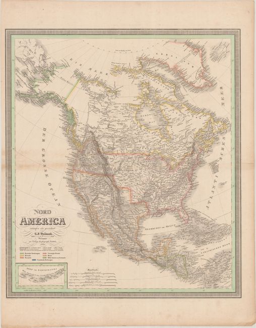
Subject: North America
Period: 1830 (dated)
Publication:
Color: Hand Color
Size:
20.1 x 22.9 inches
51.1 x 58.2 cm
This attractive German map of North America names plenty of towns and cities and features good topographical detail. Texas is still a part of Mexico, and the border of Oregon Territory extends well into present-day British Columbia reflecting U.S. interests in the region. The Midwest, east of the Rocky Mountains, is identified as Missouri Territory while Wisconsin is labeled Northwest Territory. At bottom is an inset of the Aleutian Islands. The map is color-coded to indicate the holdings of various powers on the continent. Surrounded by a keyboard-style border.
References:
Condition: B+
Contemporary outline color with some minor toning along the centerfold at left. A short centerfold separation in the right blank margin has been closed on verso with archival tape.