Subject: Colonial North America
Period: 1780 (circa)
Publication: Atlas de Toutes les Parties Connues du Globe Terrestre
Color: Black & White
Size:
12.6 x 8.5 inches
32 x 21.6 cm
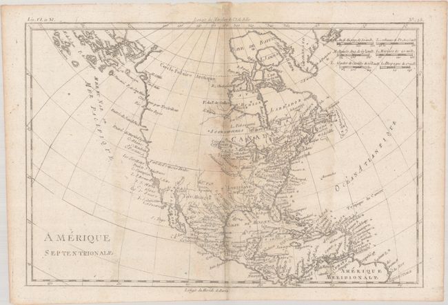
The entire western part of the continent is left mostly blank on this map of North America. Indian tribes occupy the edges of defined territory, including Apaches, Sioux, Outagamis, and Assenipouels. The British Colonies and a few major cities are named along the eastern seaboard and in the Great Lakes region. Alaska is shown as a group of islands, the largest of which is labeled Alaschka. Place names fill Mexico and the Caribbean.
References: Sellers & Van Ee #170.
Condition: B
There is some toning and a couple of small archival repairs along the centerfold. The middle section of the sheet is dampstained and is thin to the left of the centerfold above and below "Port de Francis Drake."