Subject: New Zealand
Period: 1787 (circa)
Publication: Atlas Encyclopedique
Color: Black & White
Size:
9.3 x 13.6 inches
23.6 x 34.5 cm
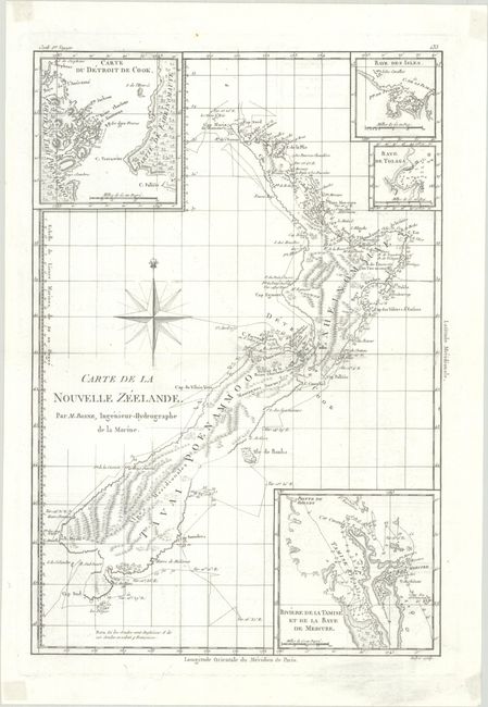
This uncommon, detailed chart of the islands shows the track of Captain Cook's first voyage. The map is finely engraved with detail and includes four insets showing the Coromandel Peninsula (here called Riviere de la Tamise et de la Baye de Mercure), Cook Strait, Bay of Islands, and Tolaga Bay. The waters are filled with soundings and anchorages. Engraved by Andre.
Rigobert Bonne was an important French cartographer of the late 18th century. In 1773 he succeeded Jacques Bellin as the royal cartographer in the Office of the Hydrographer at the Depot de la Marine. Working in his official capacity, Bonne compiled some of the most detailed and accurate maps of the period.
References:
Condition: A
A nice impression on a bright sheet of watermarked paper with faint offsetting. There are remnants of tape in the corners on verso that are faintly visible on recto.