Subject: Pacific Ocean, World War II
Period: 1943 (dated)
Publication:
Color: Printed Color
Size:
34 x 45 inches
86.4 x 114.3 cm
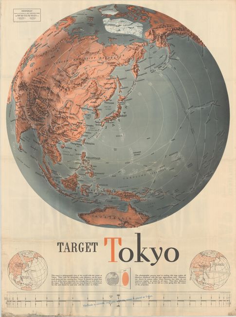
This impressive piece of World War II-era persuasive cartography centers on Tokyo, Japan. The "photographic map" stretches from Scandinavia and Russia through Asia and across the Bering Strait to show Alaska and the west coast of North America down to San Francisco. The map also extends to include Australia, a large polar ice cap, and Greenland. A detachable scale at bottom can be used to measure distances along any line running through Tokyo; two helpful diagrams at bottom demonstrate how to use it. Despite the map's title, at the time of the map's publication, there had been relatively few bombing raids on Japan aside from the 1942 Doolittle Raid. The heaviest strategic bombing campaigns on Japan came after the introduction of the B-29 Superfortress bomber in 1944. Drawn by F.E. Manning.
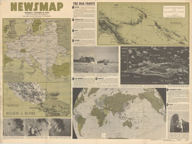
The map is one of the "Newsmaps" published by the U.S. Army from 1942-46. These maps were designed to keep American troops updated on the war. The weekly posters were distributed and posted in every American installation in the world and were intentionally more visual than descriptive to help engage and motivate personnel.
References:
Condition: B+
Issued folding with some light extraneous creasing adjacent to the fold lines with some related minor surface wear. There is some light soiling along the bottom left sheet edge and a short fold separation in the right blank margin.