Subject: Africa
Period: 1780 (circa)
Publication: Atlas de Toutes les Parties Connues du Globe Terrestre
Color: Hand Color
Size:
12.5 x 8.3 inches
31.8 x 21.1 cm
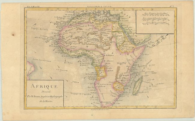
Most detail on this nice map of the African continent is limited to the coasts and northern regions, with the interior left mostly blank. The majority of Africa is simply labeled Ethiopie. There is no clear source for the Nile, and its course is completely wrong. The oceans are engraved to show the direction of the trade winds. Simple cartouches enclose the title and the three distance scales.
Rigobert Bonne was an important French cartographer of the late 18th century. In 1773 he succeeded Jacques Bellin as the royal cartographer in the office of the Hydrographer at the Depot de la Marine. Working in his official capacity, Bonne compiled some of the most detailed and accurate maps of the period.
References:
Condition: B+
A crisp impression with light toning and a paper flaw in the left margin.