Subject: China, Korea & Japan
Period: 1640 (circa)
Publication:
Color: Hand Color
Size:
19.6 x 16.2 inches
49.8 x 41.1 cm
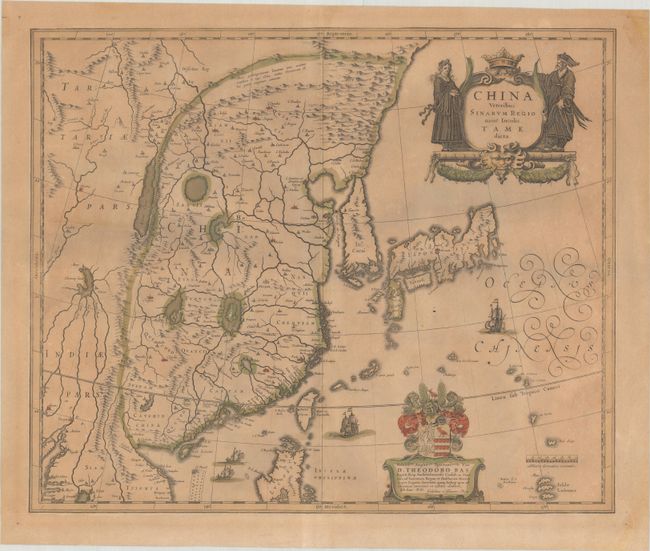
Several large lakes dominate the topography of this elegantly engraved map of China. The Great Wall forms the northern boundary of China. The fictitious Chiamay Lacus is shown with numerous rivers flowing south into India and Siam. Korea is depicted as a strangely shaped island separated from the mainland by a narrow strait. Taiwan is located in a roughly correct position, named as both Pakan al I. Formosa, with the additional place names of Gillira, Wankan, and Tayoan. The three main islands of Japan are shown on the Ortelius/Teixeira model. A fine title cartouche is flanked by a Chinese woman and man. The map is further adorned with a coat of arms (dedicated to Theodore Bas, a director of the Dutch East India Company), European ships and Chinese sampans.
References: Caboara #23; Van der Krogt (Vol. II) #8410:2A.
Condition: B
Full contemporary color on a moderately toned sheet with minor soiling. The map has been trimmed to the neatlines and backed in old paper. There are a few stains and repaired tears in the blank margins.