Subject: Asia
Period: 1775 (dated)
Publication: Atlas Universel
Color: Hand Color
Size:
20.5 x 19 inches
52.1 x 48.3 cm
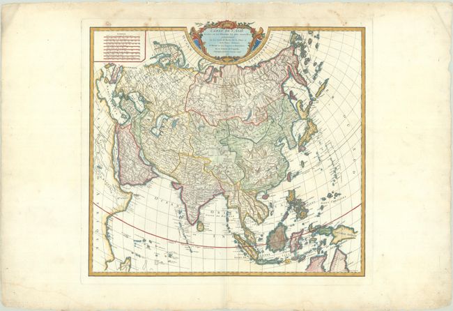
This is the third state of Didier Robert de Vaugondy's map of Asia, based primarily on the work of Sanson, Delisle, and D'Anville. The shape of the continent is fairly accurate, although spurious geographical details remain in the interior. Hokkaido (Jedso) is properly shown as a separate island, although a small Terre de la Compagnie still appears to the east. The sea between Japan and Korea is called Mer de Coree (Sea of Korea). Tibet is also named Dalai Lama and the Malay Peninsula extends too far to the west. New Guinea is only partially delineated, with the ocean to the south left completely blank. Engraved by Guillaume de la Haye.
References: Pedley #375; Yeo #138.
Condition: B+
A crisp impression on watermarked paper with some light dampstaining that just enters the image at top as well as in the bottom margin. Two tears at top that extend 1.5" into the image have been archivally repaired on verso along with several small edge tears confined to the margins. There is a small abrasion just above the border at top left.