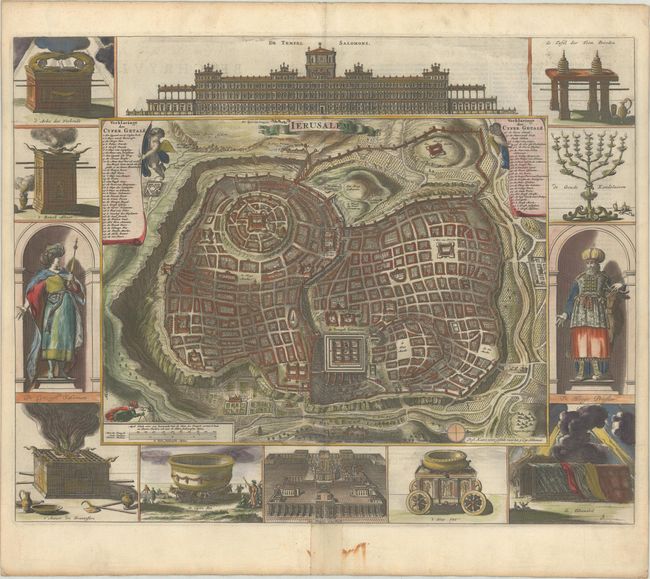
Subject: Jerusalem, Holy Land
Period: 1682 (published)
Publication:
Color: Hand Color
Size:
18.1 x 14.2 inches
46 x 36.1 cm
Great bird's-eye plan of the holy city surrounded by engravings of religious icons, Salomon and a High Priest. Reportedly after Vallapando's imaginary city plan, the map was published in a Dutch Bible. At the top is a large and ornate elevation of the Temple of Solomon and at bottom is a plan of the Temple Ezechiels. The map is copied from Nicolas Berchem's 1663 map of Jerusalem. Dutch text on verso. This is the first state.
References: Poortman & Augusteijn #133 GI; cf. Laor #1150.
Condition: B+
A crisp impression on a bright sheet with marginal soiling and a stain in the bottom margin that is partially obscured by an old paper repair along the centerfold, with a 1/2" centerfold separation remaining within the image. THe paper is a bit cockled.