Subject: Sicily, Sardinia, & Malta
Period: 1720 (circa)
Publication:
Color: Hand Color
Size:
22.6 x 19.3 inches
57.4 x 49 cm
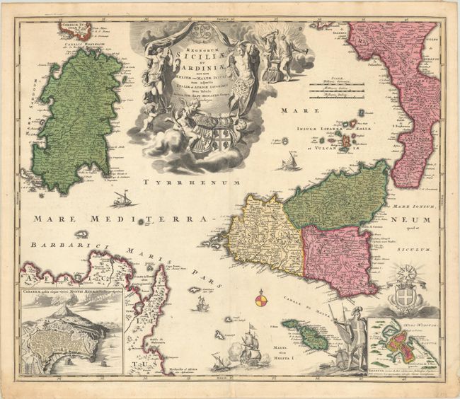
This decorative map depicts Sicily, Sardinia, the Maltese islands, the southern tip of Italy, and a portion of Tunisia. There are plenty of place names and good topographical detail throughout the map. An inset at bottom left shows Mount Etna erupting above a city plan of Catania. Another inset, at bottom right, zooms in on Malta's capital Valletta and is surrounded by a Maltese knight and coat of arms. Several ships and a simple compass rose fill the Mediterranean. The map is adorned with an elaborate and ornate title cartouche that features Ceres, Bacchus, Vulcan, and putti holding the coats of arms for Sicily and Sardinia.
References:
Condition: A
Full contemporary color on watermarked paper. There is some minor staining almost entirely in the bottom blank margin that has been reinforced on verso with tissue.