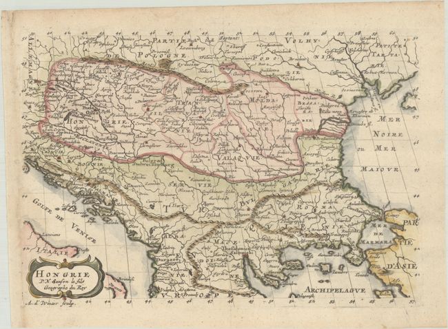
Subject: Balkans, Hungary
Period: 1683 (published)
Publication: L'Europe
Color: Hand Color
Size:
10.1 x 6.9 inches
25.7 x 17.5 cm
This small map covers southeastern Europe from Vienna to the Black Sea and from southern Poland to Greece. It shows the political divisions, major topography, cites and towns. Adorned with a strapwork title cartouche. Engraved by Antoine d'Winter. This is the first state, prior to the addition of a border.
Sanson's small maps from his L'Europe en Plusieurs Cartes..., first published in 1656 and engraved by A. Peyrounin, were copied several times by various map publishers. Johann David Zunners made copies of Sanson's maps for his German translation of Die Gantze Erd-Kugel in 1679. Johannes Ribbius and Simon de Vries published copies in 1682 and 1683, with new maps engraved by Antoine d'Winter. The plates were later sold to Francois Halma, who used them in 1699 and then again in 1705 with the titles re-engraved in Dutch. The titles on the d'Winter plates were re-engraved back into French, and then used by Nicholas Chemereau in 1715 and by Henri du Sauzet in 1738.
References: Pastoureau, SANSON VII F [11].
Condition: A
A crisp impression on a sheet with a watermark of three stacked circles. The binding holes in the left blank margin have been closed with old paper on verso.