Subject: Russia in Europe
Period: 1642 (circa)
Publication:
Color: Hand Color
Size:
21.6 x 16.8 inches
54.9 x 42.7 cm
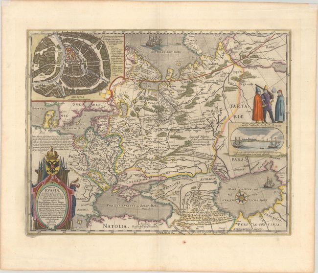
This is Blaeu's version of Hessel Gerritsz' rare and significant map of Russia, which he compiled from manuscripts brought back by Isaac Massa. The map covers the European part of the Russian Empire extending from Poland to the steppes of Tartary, and from the Mourmanskoy More (Barents Sea) to the Black and Caspian seas. The large inset plan of Moscow is attributed to the Crown Prince Fydor Gudonov. The map is richly decorated with a large title cartouche, sailing ships, a compass rose, three Russian gentlemen, and an inset view of Archangel Sckagoroda. Dutch text on verso, published between 1642-64.
References: Van der Krogt (Vol. II) #1800:2.2.
Condition: A
A dark impression on a sturdy sheet with a small paper flaws east of the Caspian Sea and another in the bottom margin. There are a few extraneous creases in the wide, blank margins and remnants of hinge tape at top on recto.