Subject: Low Countries
Period: 1770 (circa)
Publication:
Color: Hand Color
Size:
22.8 x 19.6 inches
57.9 x 49.8 cm
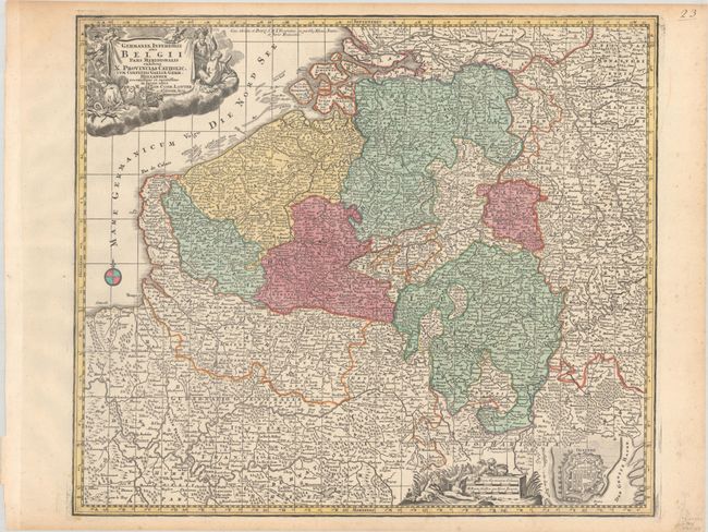
This attractive and finely engraved map covers Belgium, Flanders, Luxemburg, and parts of Holland, France, and Germany. It is densely filled with towns, villages, churches, and many rivers. Among the cities named are Brussels, Antwerp, Ghent, Rotterdam, Calais, Rouen, Dusseldorf, and Cologne. It is decorated with two allegorical cartouches, with symbols of the region's history, wisdom, and might in the title cartouche and a river god next to the distance scales. At lower right is a plan of Ostende detailing the fortified city that figured prominently in the Dutch and Spanish conflict during the Hundred Years' War. This is the second state, with the addition of a graticule and Lotter's privilege in the North Sea.
References:
Condition: A
A nice impression with full contemporary color on a bright sheet with the watermark of a large "4" and the initials "MG," and light toning along the edges of the sheet.