Current Auction
Lot 387
Current Auction

"Cruchley's New Travelling Map and Itinerary Comprising the Whole of England, with Part of Scotland & Ireland and a Portion of France and the Netherlands...", Cruchley, George Frederick

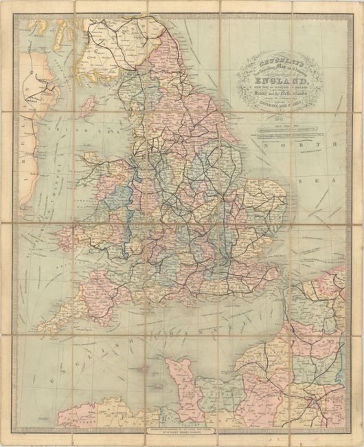
Subject: England & Wales

Period: 1841 (dated)

Publication:

Color: Hand Color

Size:
20.3 x 25.1 inches
51.6 x 63.8 cm
Download High Resolution Image
(or just click on image to launch the Zoom viewer)

This folding map of England and Wales extends to show parts of Scotland, Ireland, and northern France. Railroads, canals, and roads are delineated, with distances specified for ship lines, roads, and post relays in France. A floral wreath cartouche encases the title, and the map is surrounded by a keyboard-style border. Dissected and backed in linen with green mottled-paper end covers and a printed table of railways on verso.

References:

Condition: B

There is light soiling, numerous manuscript notations in blank ink, minor offsetting, and a few splits in the linen at fold intersections.

Estimate: $100 - $130

Current High Bid:
$0

Reserve: Reserve Not Met
Next Bid: $50

Bid Increments
$50 - $99$5
$100 - $249$10
$250 - $499$25
$500 - $999$50
Terms & Conditions