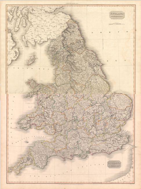
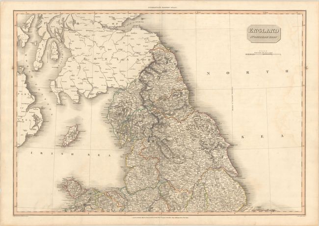
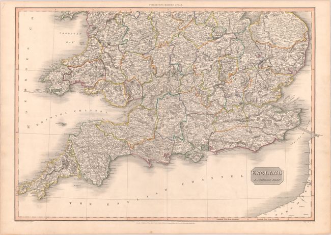
Subject: England & Wales
Period: 1811 (dated)
Publication: Pinkerton's Modern Atlas
Color: Hand Color
Size:
28.3 x 19.8 inches
71.9 x 50.3 cm
An attractive two-sheet map of England & Wales, extending to include southern Scotland and the eastern coast of Ireland. There is excellent inland detail including canals, rivers, topography by hachure, and scores of towns and villages throughout. Along the coastlines are good detail of bays, offshore islands, and sand bars. A notation linking Dover to Calais states that English engineers have determined its length to be 137,455 feet (26 miles) while the French measure it at 137,442, a remarkable 0.01% variation. Drawn by L. Hebert and engraved by Samuel Neele.
References:
Condition:
Contemporary outline color on "J Whatman 1810" watermarked paper. There is some light offsetting and two small stains along the side borders of the northern sheet. Southern sheet (A), Northern sheet (B+). The first image is a composite image - the map is in two separate sheets.