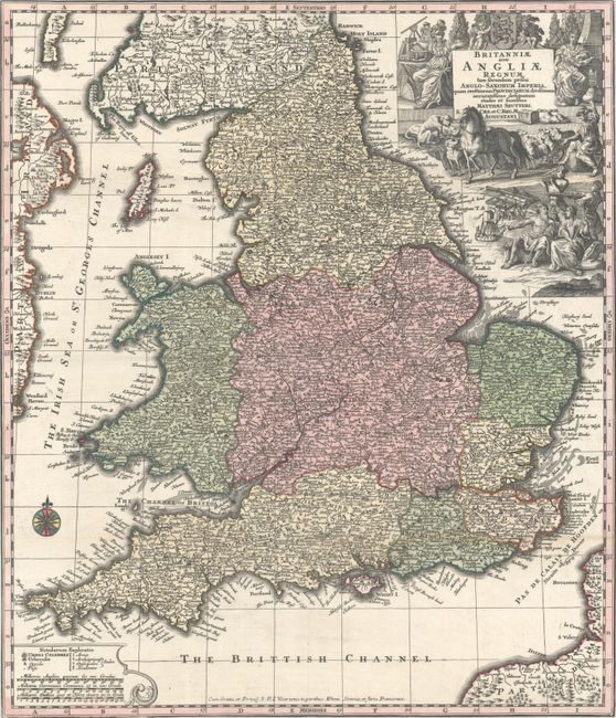
Subject: England & Wales
Period: 1740 (circa)
Publication:
Color: Hand Color
Size:
19.2 x 22.3 inches
48.8 x 56.6 cm
This attractive map is based on Homann's (and Seutter's) earlier map of England and Wales. It is densely filled with information on cities, towns, villages, churches, roads and canals. The prominent title cartouche combines symbolic and everyday figures in a display of life in Georgian times with scenes illustrating the sciences, trade and industry, agriculture and maritime activity throughout the realm. This is the second state of the map with the privilege added at bottom.
References: Shirley (BI to 1750) Seutter 2.2.
Condition: B+
A sharp impression with full contemporary color. This example has been trimmed to the neatlines and issued folding. There are remnants of hinge tape on verso and minor toning along several folds.