Subject: Western England
Period: 1645 (circa)
Publication: Le Theatre du Monde ou Nouvel Atlas...
Color: Hand Color
Size:
19.6 x 16.2 inches
49.8 x 41.1 cm
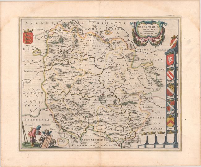
This beautiful map of Herefordshire is engraved with delicately rendered forests, mountains and towns. Malvern Hills is on the eastern edge of the map with Monmouth to the south. Ludlow is located in the far northern part of the map and Brestayne and Hay border the west. The crests of prominent families are shown at right, with several empty crests. The map is further embellished with a title cartouche featuring garlands and the scale of miles attended by a surveyor and a pair of putti. French text on verso, published between 1645-48.
References: Van der Krogt (Vol. II) #5510:2.
Condition: A
Full contemporary color on a bright sheet of watermarked paper. There is a pair of dampstains confined to the top blank margin.