Subject: Northern England
Period: 1695 (circa)
Publication: Camden's Britannia
Color: Hand Color
Size:
14 x 16.6 inches
35.6 x 42.2 cm
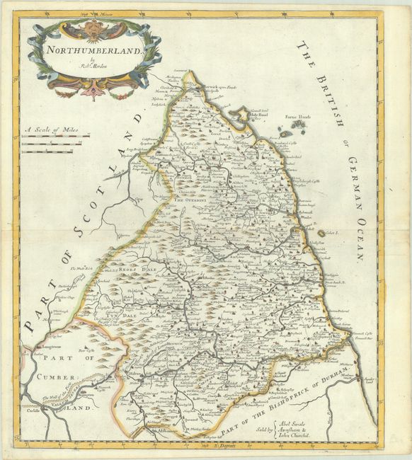
This county map of Northumberland shows numerous place names, churches, rivers, and topography. A road from Newcastle to Barwick is depicted, as well as the wall of the Picts extending from Newcastle past Carlisle. The map is decorated by an attractive title cartouche and three distance scales. Sold by Abel Swale Awnsham and John Churchill.
Morden was one of the first English cartographers to show longitudes measured from the meridian of St. Paul's Cathedral (shown in degrees at the bottom of the map) and time in minutes measure locally from the sun (shown at the top in Roman numerals). The roads on his maps are based on Ogilby's earlier survey. The Britannia was first published by historian William Camden (1551-1623) in 1586. After the publication of the final edition of Britannia in 1637, the work was not published again until 1695 when Gibson revised and translated the text from the original Latin. He included fifty maps, mostly of the English counties, prepared by Robert Morden, replacing the outdated maps of Christopher Saxton.
References: Shirley (BL Atlases) T.CAMD-5a.
Condition: A
A crisp impression on a bright sheet with a horse medallion watermark, minor toning along the edges of the sheet, and remnants of framing tape on verso.