Subject: Chile
Period: 1799 (dated)
Publication: Atlas Maritimo Espanol
Color: Hand Color
Size:
22.6 x 33.9 inches
57.4 x 86.1 cm
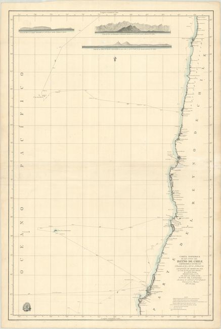
This handsome sea chart depicts the majority of the Chilean coastline from just north of Cobija to south of Concepcion. Place names are confined to the coast, with only the city of Santiago appearing inland. Three coastal views are depicted at top. The routes of the twin corvettes of the Spanish Navy, Descubierta and Atrevida, are depicted, along with miniature pointing hands to identify the direction of their voyage. The ships were built for the Malaspina Expedition, the most important voyage of discovery dispatched by Spain in the 18th century. Commanded by Alessandro Malaspina and José de Bustamante y Guerra, the goals of the expedition were to increase geographic and scientific knowledge, and to monitor the status of the Spanish empire. Over four years, the ships traveled from Cadiz, Spain, to South America, Alaska, and Australia before returning home to Spain. This map was created by Felipe Bauza and published in the Atlas Maritimo Espanol by the Deposito Hidrografico, whose seal appears at bottom left. Drawn by Pedro Manuel Gangoiti and engraved by Juan Moreno Tejada.
References: Phillips (Atlases) #4155-33.
Condition: B+
A sharp impression on "Joan Serra" watermarked paper with minor soiling and a printer's crease at right. Additional horizontal folds have been added by a previous owner.