Subject: Ancient World
Period: 1702 (circa)
Publication: Le Sainte Bible ... Tome Troisieme
Color: Hand Color
Size:
16.3 x 12.4 inches
41.4 x 31.5 cm
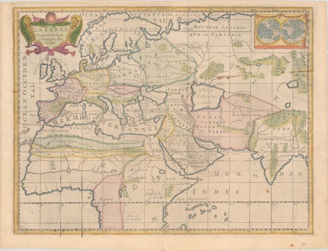
This uncommon map illustrates those parts of the world that were known in ancient times, covering all of Europe, Northern Africa and Central Asia. The ancient regions and cities are named and large rivers and lakes are noted, but there is little other detail. The cartography is up-to-date, rather than on the Ptolemaic model. The inset at upper right is a double hemisphere world showing the contemporary knowledge of the whole world. It features the mythical island of California and large southern continent. Evidence of a plate repair is in the bottom border. Published in Jean-Francois Broncart's Le Sainte Bible ... Tome Troisieme.
References:
Condition: B+
On a sheet with a Strasburg bend & lily watermark and a bit of show through at top left from an old stamp on verso. There are a few small stains, light printer's ink residue, and a faint horizontal crease across the center of the map.