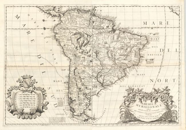
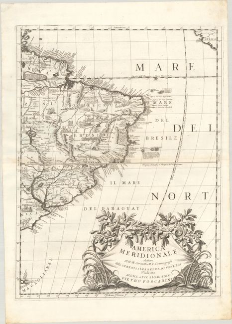
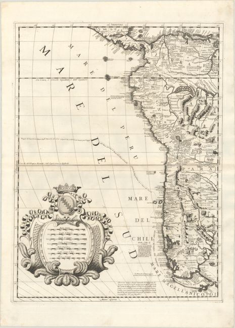
Subject: South America
Period: 1691 (circa)
Publication: Atlante Veneto
Color: Black & White
Size:
17.9 x 23.8 inches
45.5 x 60.5 cm
Coronelli drew on many sources for his 2-sheet map of South America including several reports of voyages to which he had access. Therefore the map is considered one of the best depictions of the era. A small version of Lac de Parime is located on the equator with a notation questioning its existence. The Rio de la Plata emanates from the large Lago de Los Xarayes. Jacob le Maire and Willem Cornelisz Schouten's route around Cape Horn and through the South Pacific is traced. This important voyage (1615-17) opened a new shipping route from the Atlantic to the Pacific and proved that Tierra de Fuego was an island and not a part of some massive southern continent. From a purely decorative point of view, the map is a superb example of the mapmaker's art. There are two large cartouches and the interior is filled with small depictions of animals and natives, including jaguars, llamas, hunters, torture scenes, and cannibalism. If joined, the map would measure approximately 35 x 24". A superb large map of the continent.
References: Shirley (BL Atlases) T.CORO-7a #14 & 15.
Condition: A
Dark, sharp impressions on bright sheets with the watermark of the initials "BV." There is a hint of toning along the centerfold, some tiny, unobtrusive spots in the south Pacific, and a professionally repaired tear on the eastern sheet that enters less than 1" into the image at top left. The first image is a composite image - the map is on two separate sheets.