Current Auction
Lot 334
Current Auction

Early, Detailed Map of Aruba Showing Locations with Gold and Silver

"Kaart van het Eiland Aruba Gevolgd Naar de Opmeting in den Jare 1820 Gedaan..."
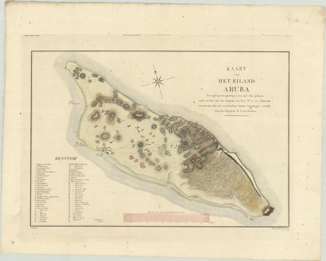
Subject: Aruba

Period: 1825 (published)

Publication:

Color: Hand Color

Size:
17.7 x 12 inches
45 x 30.5 cm
Download High Resolution Image
(or just click on image to launch the Zoom viewer)

This rare map of Aruba, one of the Dutch Antilles islands, Is the first detailed map of the island, and the first map to name Oranjestad. The map shows great detail of the topography of the land with several early settlements, along with a numbered key identifying over 60 locations, including areas where gold and silver had been found. The map was based on the explorations of Dutch captains William Augustus van Spengler in 1820 and R. F. van Raders in 1825. Engraved by F. Etiennez.

References:

Condition: B+

A crisp impression on a bright sheet with Strasbourg lily and "Van Gelder" watermarks. There is scattered foxing and minor soiling. The sheet is deckle edged.

Estimate: $1,200 - $1,500

Current High Bid:
$0

Reserve: Reserve Not Met
Next Bid: $600

Bid Increments
$500 - $999$50
$1,000 - $2,499$100
$2,500 - $4,999$250
$5,000 - $9,999$500
Terms & Conditions