Subject: Gulf of Mexico & Caribbean
Period: 1950 (dated)
Publication:
Color: Printed Color
Size:
15.5 x 12.4 inches
39.4 x 31.5 cm
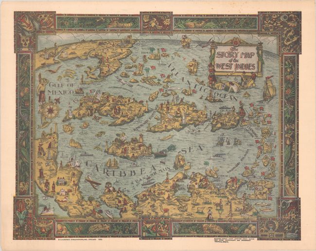
This charming and colorful map of the Caribbean presents a fun and engaging visual aid to learn about the region. Each island is filled with quaint images of Natives, primary resources, key cities, and the local culture. Several historical notes are also included. The map extends to include parts of the United States (as far north as Chicago, Detroit, and New York City), Mexico, Central America, and South America. The superb border is "adapted from Native West Indian handicraft and indigenous tropical fruits." Published by Chicago-based Colortext Publications, Inc., which created a series of "Story Maps" of different countries and regions. Later edition with a darker color scheme.
References: Hornsby (Picturing America) #101.
Condition: B+
There is some light foxing, mostly at top right.