Subject: Mexico & Texas
Period: 1859 (dated)
Publication: A New Universal Atlas...
Color: Hand Color
Size:
25.8 x 16 inches
65.5 x 40.6 cm
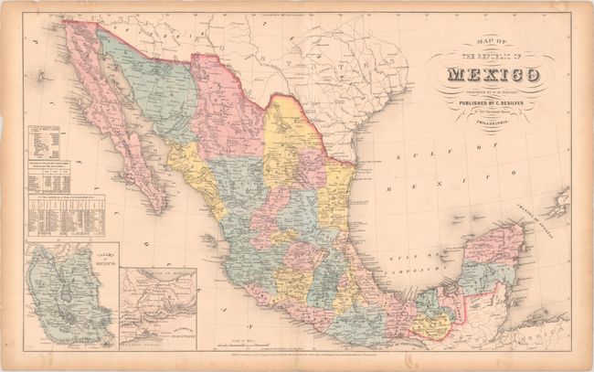
This colorful, nicely engraved atlas map features two insets, Valley of Mexico and The Isthmus of Tehuantepec. The scarce double-page map was compiled by W.H. Holmes and is only seen in the last couple years of this atlas' production. It includes many place names and locates cities, villages, forts, roads, rivers, and the route of the proposed Aransas Railroad from Aransas, Texas to Mazatlan. Three tables provide information on exports, gold and silver minting, and the population of each state. The map has simple neatlines rather than the decorative border featured on most in this atlas.
References: Rumsey #6727.042.
Condition: B+
Contemporary color with two short archivally repaired edge tears that enter map image at top. There is light toning along sheet's edges and a centerfold separation in the bottom blank margin.