Subject: New York City, New York
Period: 1865 (dated)
Publication:
Color: Hand Color
Size:
17.4 x 24.9 inches
44.2 x 63.2 cm
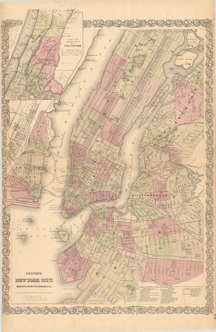
This double-page map covers Manhattan to 125th Street, along with Long Island City, Brooklyn, Hoboken, and Jersey City. An inset at top left extends the main map up to Yonkers. Highly detailed, the map shows the street grid pattern, parks, railroads, ferry routes, and docks. The map was published before the construction of the Brooklyn Bridge, though a "suspension bridge" is drawn in its location indicating the bridge was in the planning phase (construction began in 1869).
References: Phillips (Maps) p. 537.
Condition: B+
Full contemporary color with light toning along the sheet edges. There is a short centerfold separation at left and two short edge tears in the right decorative border that have been closed on verso with archival tape.