Subject: St. Louis, Missouri
Period: 1837 (dated)
Publication: Sen. Doc. 139, 25th Congress, 2nd Session
Color: Black & White
Size:
40.8 x 15.3 inches
103.6 x 38.9 cm
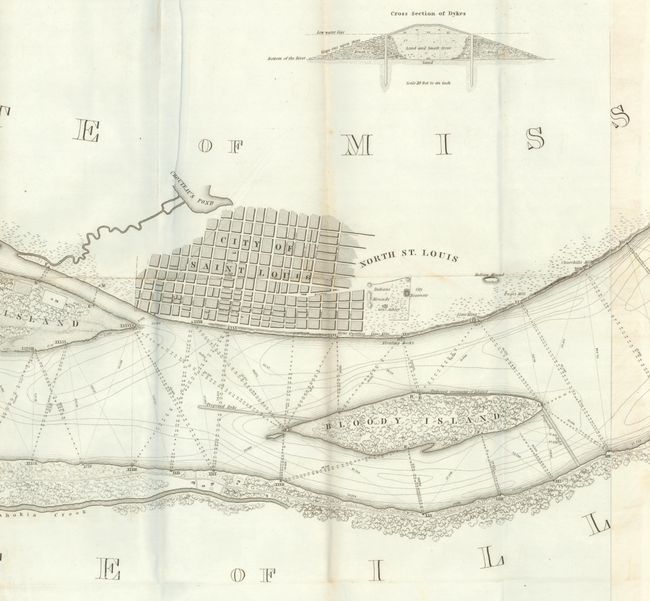
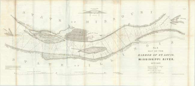
Robert E. Lee surveyed and produced three maps of the Mississippi River in 1837. This one, joined on two sheets, covers that portion of the river in the vicinity of St. Louis and includes a street plat of the city (with many streets named). It locates stone quarries, lime kilns, Indian mounds, etc. The islands of Cascarot (partial), Bloody, Duncan's, and part of Cahoe are shown. There are proposed dikes and revetments to improve the harbor. A cross-section of a typical dyke is illustrated. Finely drawn by Lee, it contains very good detail of the area.
References: Claussen & Friis #191; Phillips (Maps) p. 764.
Condition: B+
Issued folding on a bright sheet with some light toning and soiling along the folds and the top left panel. There is some minor offsetting, a few short splits at the fold junctions, and an archivally repaired short edge tear at left.