Subject: Maryland
Period: 1800 (circa)
Publication: Carey's General Atlas
Color: Black & White
Size:
16.7 x 11.1 inches
42.4 x 28.2 cm
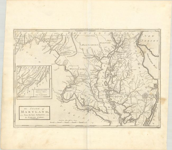
Mathew Carey was a seminal figure in early American publishing; establishing the first publishing firm to specialize in cartography and issuing the first atlas devoted exclusively to American maps. He set up an elaborate cottage system of craftsmen for compiling, engraving, printing, and coloring maps. This practice was emulated by later American cartographic publishers such as John Melish and Henry S. Tanner. The American Atlas concept was also adopted by other publishers in both the United States and Europe.
Second state of the first American-produced atlas map of Maryland. Details include towns and villages, roads, and watershed of the state. The city of Washington is shown by a block plan with Georgetown. The western boundary line extends north along the course of the Potomac. Inset at left: "Continuation of the Potowmac River, from Fort Cumberland." The distance scale is in "American Miles." Engraved by William Barker, who worked on other maps in Carey's American Atlas, where this map also appeared. Plate number 35 at top right.
References: cf. Phillips (A) #1365-35; Wheat & Brun #510.
Condition: B+
A nice impression with some light soiling. A centerfold separation that enters 0.75" into map image at bottom has been repaired on verso with archival materials.