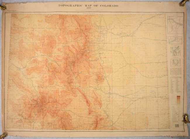
Subject: Colorado
Period: 1913 (dated)
Publication:
Color: Printed Color
Size:
53.7 x 36.3 inches
136.4 x 92.2 cm
This scarce, separately issued large-format map shows remarkable topographical detail of the state. The color scheme indicates elevation level, with the darkest shade indicating levels over 13,000 feet. In addition to the topography, the map locates post offices, land offices, roads, railroads and Indian reservations. At right are insets of the Canon City District, Leadville, Denver and Cripple Creek. The map was drawn by H.C. Woods and prepared by Russell George of the Colorado State Geological Survey, based largely on data from the U.S. Geological Survey. Drawn on a detailed scale of 8 miles per inch. Backed with old linen.
References:
Condition: B
A colorful example on a lightly toned sheet that has been backed with linen. There are numerous tiny edge chips and small tears in the margins, including three at right and one at left that enter the image. Some extraneous creasing is mostly located at right.