Subject: Western United States & Pacific Islands
Period: 1845 (published)
Publication: Narrative of the United States Exploring Expedition
Color: Black & White
Size:
11.5 x 8.4 inches
29.2 x 21.3 cm
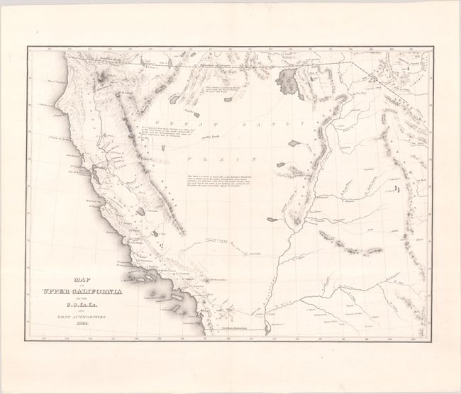
This lot features a crisply drawn map that covers all the American West south of 42 ° N. and west of the Rocky (Anahuac) Mountains, with by far the greatest detail in California. The cartography is distinctly pre-Fremont. The Sacramento and San Joaquin valleys combine to form the large Buenaventure Valley with the Rio San Buenaventura in the area of today's Salinas River. The map predates the discovery of gold by several years, but in the vicinity of Sutter's Mill the settlement of New Helvetica is located. Along the coast the mission towns are named, but there is no mention here of Los Angeles even though it was a self-sustaining farming community as early as 1821. The Colorado River is shown trending in an oddly straight course giving no credit to the Grand Canyon. The Great Basin, called the Great Sandy Plain, is crossed by Smith's Track and is bounded east and west by the Colorado Range and the California Range. The Great Salt Lake is Youta Lake and the Salt River is called the Inconstant R. Interesting notes explain the unknown qualities of the land and another describe the Indians as "the most miserable objects in creation," an unfortunate depiction.
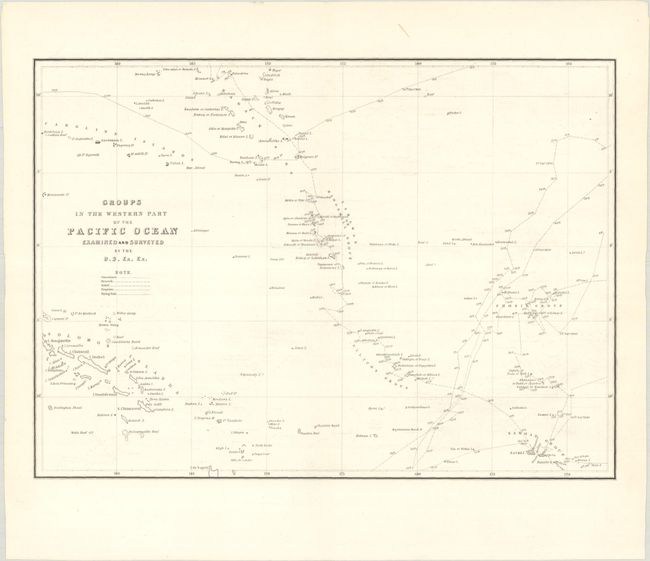
Also included in this lot is another fine map from the same publication, covering the region from the Caroline and Solomon Islands east to Samoa. It shows the routes of the five ships on the expedition in different patterns.
References: Wheat (TMW) #458; Wheat (Gold) #23.
Condition: A
Crisp impressions on clean, bright sheets. The map of the western United States is fine (A+) and the map of the Pacific Ocean is near fine (A) with a hint of offsetting.