Subject: Upper Midwestern United States
Period: 1838 (dated)
Publication: An Illustrated Atlas, Geographical, Statistical, and Historical, of the United States...
Color: Hand Color
Size:
11.1 x 14.3 inches
28.2 x 36.3 cm
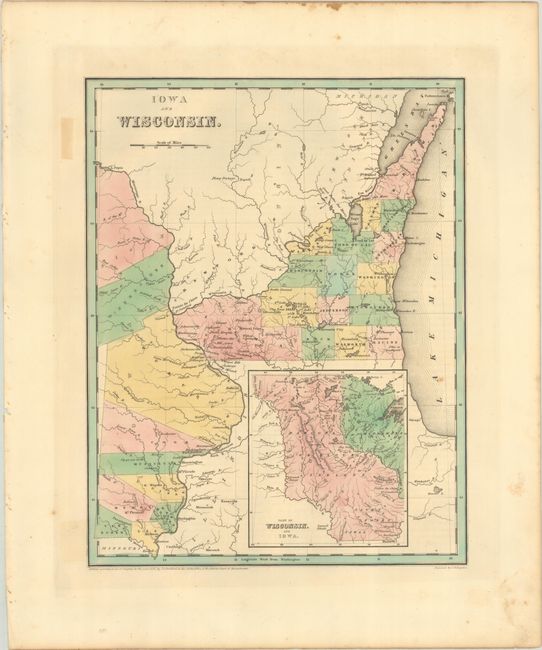
A scarce, early copper engraved map that also includes part of today's Minnesota. The map extends from Missouri's northern border well into Canada and east to Lake Michigan. There are only 8 named counties in Iowa, which wouldn't become a state for another 8 years, with Sioux and Winnebago lands to the north. Wisconsin is largely unsettled with only 16 counties named in the southeastern part of the state. The large inset, based on Nicollet, details the lands of the Dahcota or Sioux, Chippeways, Fox, Iowa, and Saulk Indians, and the watershed of the Missouri and Mississippi rivers. Includes early information on forts, rapids, portages, and more. This map is among one of the first wave of detailed maps of these territories to appear in commercial atlases. Engraved by G.W. Boynton. Accompanied by 3 pages of related text describing the region.
References: Phillips (Atlases) #1381; Ristow pp. 270-271.
Condition: A
Full contemporary color with a few faint spots in the image. There is some minor toning and foxing in the blank margins.