Subject: Southern United States
Period: 1823 (dated)
Publication:
Color: Black & White
Size:
25.2 x 19.7 inches
64 x 50 cm
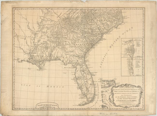
This is a later edition of this important map that was first published in 1776 in a British military atlas. It was based on the work of De Brahm, Collet, Mouzon and the important hydrographical surveys of the coast of Florida and the Bahamas by Bernard Romans. The map appears to be identical to the 1794 edition and has not been updated to reflect development in the trans-Appalachian West. Louisiana (1803) and Florida (1819) are still spelled out in the title as "Spanish Possessions." Florida is still shown divided into East & West with a spine of mountains, labeled the Great Sandy Ridge, extending down the center of the peninsula. The map is filled with information concerning Indian Nations, with numerous trails, roads and villages located. It includes inset plans of St. Augustine and Charleston above the decorative title cartouche.
References: cf. Tooley (Amer) pp. 98-9.
Condition: B+
Issued on "W Thomas 1818" watermarked paper with a few light creases and minor toning along the outside of the border. There is some minor soiling, small edge chips, and a few archivally repaired edge tears all confined to the blank margins.