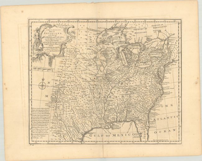
Subject: Colonial Eastern United States
Period: 1747 (circa)
Publication: A Complete System of Geography...
Color: Black & White
Size:
16.6 x 13.6 inches
42.2 x 34.5 cm
This beautifully detailed map extends west to the Rio Grande and features oversized Great Lakes, with Texas labeled Country of the Cenis, and "Louisiana" placed over the entire southern Mississippi River Valley. Teeming with information, the sheet names missions, Indian villages and tribes, and numerous rivers. Little trees dot nearly the whole map. A long note gives credit for the geography of the French portion of the map to the French cartographer Jacques Nicolas Bellin. A large, decorative title cartouche featuring an Indigenous figure and a compass rose ornament the blank western area of the map.
References: Lemmon, Magill & Wiese (Charting Louisiana) #25; McCorkle (18th C. Geog. Books) #17-28 (Vol II); Phillips (A) #603-2-58; Shirley (BL Atlases) T.BOW-2a #58.
Condition: B+
A nice impression with a Lubbert van Gerrevink watermark. A centerfold separation running along the bottom 8.5" of map image has been repaired with archival materials on verso. There is light offsetting, a minor stain, and short printer's crease near center.