Subject: United States
Period: 1904 (published)
Publication:
Color: Printed Color
Size:
6.3 x 9.6 inches
16 x 24.4 cm
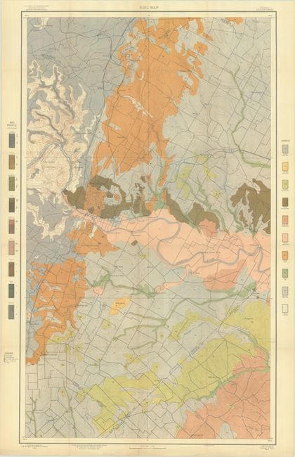
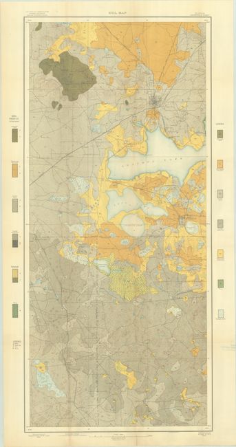
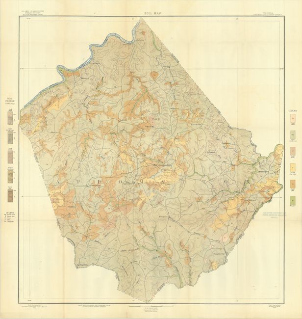
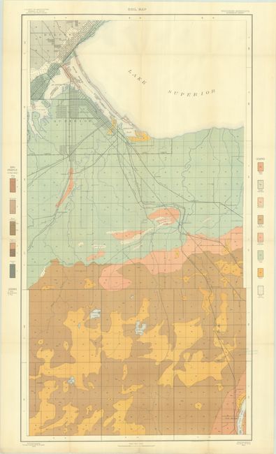
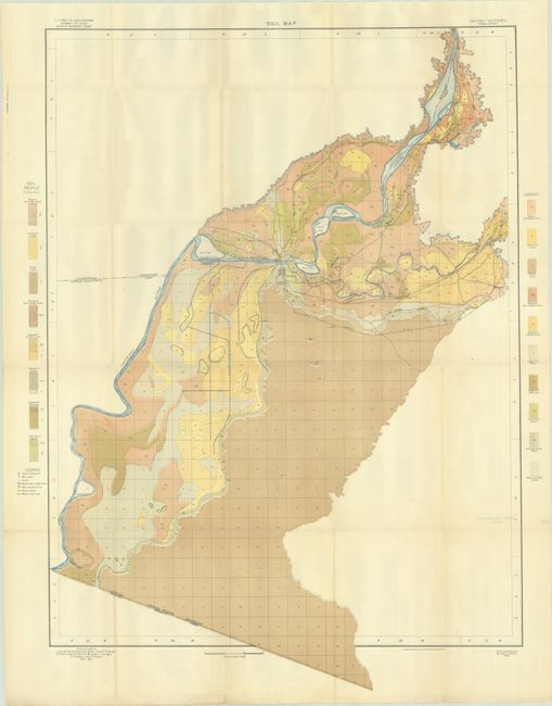
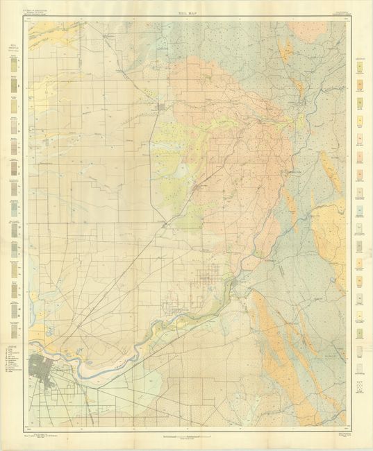
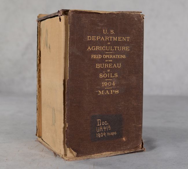
This lot includes 52 (of 53) colorful soil maps from the sixth report of the Field Operations of the Bureau of Soils, published under the direction of Milton Whitney. Of particular interest are maps of Austin (TX), Gainesville (FL), Appomattox (VA), Duluth/Superior (MN/WI), Yuma (AZ) and Sacramento (CA). The missing map is Tama County, Iowa. Each of the maps has a legend identifying the various soil profiles which are overlayed on base maps provided by the Geological Survey. In addition to the soil types, the maps depict roads, railroads, cities and towns, county boundaries and topography via contour lines. The full list of maps include:
Providence Sheet, Rhode Island
Newport Sheet, Rhode Island
Vergennes Sheet, Vermont-New York
Auburn Sheet, New York
Adams County Sheet, Pennsylvania
Appomattox County Sheet, Virginia
Lancaster County Sheet, South Carolina
Orangeburg Sheet, South Carolina
Charleston Sheet, South Carolina
Dodge County Sheet, Georgia
Bainbridge Sheet, Georgia
Gainesville Sheet, Florida
Macon County Sheet, Alabama
Sumter County Sheet, Alabama
Jackson Sheet, Mississippi
Biloxi Sheet, Mississippi
De Soto Parish Sheet, Louisiana
Anderson County Sheet, Texas
Austin Sheet, Texas
San Antonio Sheet, Texas
Lawrence County Sheet, Tennessee
Greenville Sheet, Tennessee
Warren County Sheet, Kentucky
Wooster County Sheet, Ohio
Coshocton County Sheet, Ohio
Munising Sheet, Michigan
Saginaw Sheet, Michigan
Alma Sheet, Michigan
Owosso Sheet, Michigan
Marshall County Sheet, Indiana
Scott County Sheet, Indiana
Boonville Sheet, Indiana
Superior Sheet, Wisconsin-Minnesota
Saline County Sheet, Missouri
O'Fallon Sheet, Missouri-Illinois
Webster County Sheet, Missouri
Kearney Sheet, Nebraska
Lexington Sheet, Nebraska
Allen County Sheet, Kansas
Garden City Sheet, Kansas
Cando Sheet, North Dakota
Greeley Sheet, Colorado
[Lot of 3 - Soil, Alkali and Underground Water Maps] Bear River Sheet, Utah
[Lot of 2 - Soil and Alkali Maps] Yuma Sheet, Arizona-California
Sacramento Sheet, California
[Lot of 3 - Soil, Alkali and Black Alkali Maps] Bakersfield Sheet, California
San Bernardino Sheet, California
Most maps measure approximately 31 x 26", and are loosely housed in the contemporary brown cloth case.
References:
Condition: B+
Condition code is for the maps, which are very good to near fine with a hint of toning and occasional splits at the fold junctions. Each of the maps has an old library stamp on verso for the "Institute For Plant Research" based in Yonkers, NY. The case is falling apart and only loosely holds its contents with two sections detached and one section missing.