Subject: United States
Period: 1864 (dated)
Publication:
Color: Hand Color
Size:
23.3 x 17.1 inches
59.2 x 43.4 cm
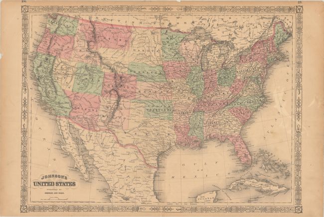
While this map presents most western boundaries as settled, it does show an early depiction of Wyoming, which is labeled in outline text only (it became a territory in 1868). Here Wyoming's northwest boundary juts out into Idaho, while Idaho in turn extend into parts of present-day southwestern Wyoming including Jackson Hole and the Grand Tetons. In the Southwest, Arizona includes the southern tip of Nevada. The track of the Pony Express, Fremont's route of 1844, the routes of the proposed transcontinental railroads, and locations of army forts are depicted. Surrounded by a decorative border. This is version 2.0 in the Johnson Map Project, which considers this map edition rare. Published in 1866.
References:
Condition: B+
Full contemporary color on a lightly toned sheet with old paper on verso reinforcing the sheet's upper corners. There is extraneous creasing in the top corners, a bit of soiling, and a centerfold separation at bottom that has been repaired with archival materials.