Subject: United States
Period: 1853 (dated)
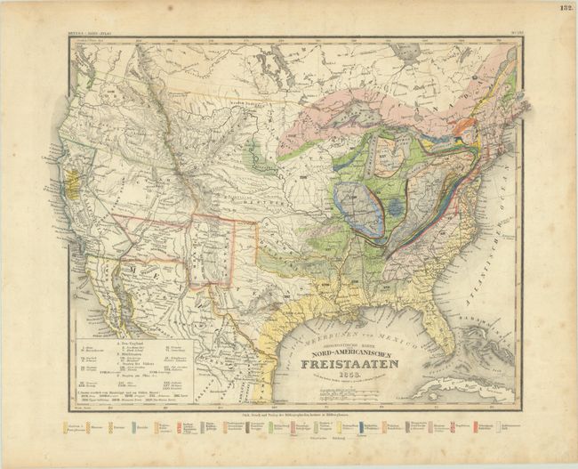
Publication: Meyer's Hand-Atlas
Color: Hand Color
Size:
15.3 x 11.6 inches
38.9 x 29.5 cm
This colorful geological map appears to be based on Charles Lyell’s map with a legend below the bottom border identifying 20 different geological groups through both texture and color. Geographically, it presents some evolving territorial configurations in the West with Upper California and Texas somewhat enlarged and distorted. The relatively new territories of Utah and New Mexico extend to the California border, and Oregon Territory extends north to the Canadian border and east to the Rocky Mountains. The Great Plains are defined as the Mandan, Osage and Ozark districts. The Gold Region is prominently depicted in California. There is good detail of the locations of Indian tribes, forts, railroads, and the routes of explorers. Published by Bibliographisches Institut in Hildburghausen.
References:
Condition: B+
Contemporary color with light scattered foxing and a faint dampstain at top left.