Subject: Gulf of St. Lawrence, Canada
Period: 1754 (dated)
Publication: L'Hydrographie Francoise…
Color: Hand Color
Size:
33.8 x 21 inches
85.9 x 53.3 cm
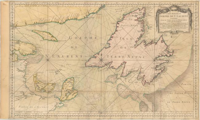
This large-scale, copper engraved map shows St. Lawrence Bay with Anticosti Island, Isle St Jean (Prince Edward Island), Isle Royale (Cape Breton Island ), Newfoundland, and the adjacent mainland. Numerous place names are identified along the coastlines, and a few topographical details are shown inland. The waters are filled with soundings, anchorages, rocks, and shoals, and the fishing banks are delineated, including the Banc aux Balaines (whale bank). The map is adorned with a decorative rococo-style cartouche. This is the third state of the map with a revised title cartouche and alterations to the southeastern coast of Newfoundland.
References: Kershaw #585.
Condition: B
Issued folding and trimmed close to the neatline on all sides, dissected along one horizontal and one vertical fold, and backed with linen. There is soiling and minor loss to rhumb lines just under the word "Golphe." The margin has been extended at left.