Subject: Eastern Canada, Great Lakes
Period: 1693 (circa)
Publication:
Color: Hand Color
Size:
30.9 x 21.6 inches
78.5 x 54.9 cm
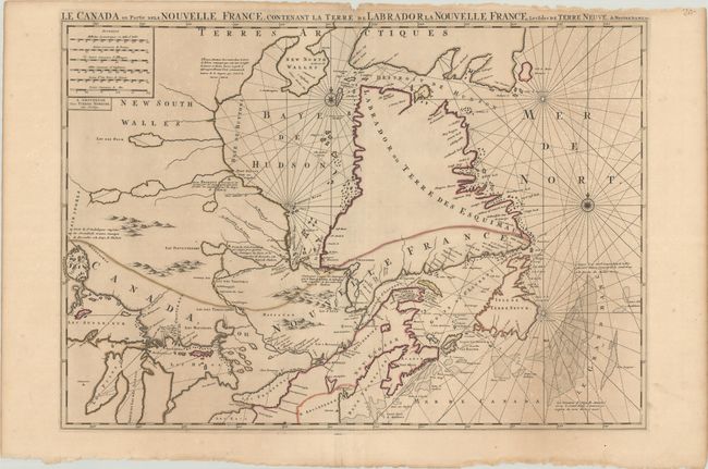
First state of this large, striking map of the region to the north of Lake Superior and eastward. Pierre Mortier based this map on Jaillot's map of 1685, which incorporated important depictions of interior rivers and lakes from the manuscripts of Jolliet, Hennepin, and Franquelin. Lake Superior is based on the Dablon prototype, and the island-filled lake north of Lake Superior (Alemenipigon) is based on Indian reports and actually represents the lake region of Manitoba. The correct shape for Hudson Bay is based on English discoveries with Port Nelson shown in roughly the correct location. Two unnamed lakes near the source of the Nelson River provide an early depiction of Lake Winnipeg, although they are located too far to the east. A large, spurious Lac des Poux is shown west of Hudson Bay. The rivers south of Hudson Bay are also well delineated. French and English fur trading posts are identified along with brief notations. This map was published in both Suite du Neptune Francois and Atlas Nouveau.
References: Kershaw #176.I; Verner & Stuart Stubbs, #9.
Condition: B+
A sharp impression with contemporary outline color on a lightly toned sheet with a Pieter van der Ley watermark and faint extraneous creasing along the centerfold. There is an old paper repair to a small hole in Le Grand Banc, with two tiny ink stains just above it causing two tiny holes. The top and bottom edges of the sheet are deckle edged.