Subject: World
Period: 1561 (published)
Publication: La Geografia di Claudio Tolomeo Alessandrino...
Color: Black & White
Size:
9.6 x 7 inches
24.4 x 17.8 cm
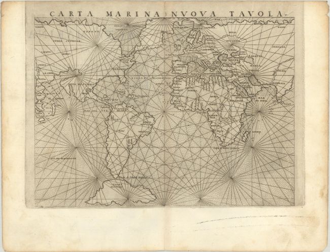
Ruscelli's mariner's map is based on Gastaldi's map of 1548. The landmasses are shown with little interior detail but with a fair number of coastal place names. The North American continent is most interesting with the western coastline extending to join Asia, and conversely the eastern coastline connects to Greenland and then onto Scandinavia. The continent is nearly divided by a large inland sea, often referred to as the Sea of Verazzano. Below South America is a huge island of Tierra del Fuego. Loxodromic lines cross the map radiating from sixteen focal points and the sea is stipple engraved. Italian text on verso, published in 1561. First state with the plate mark running off the sheet in the top margin.
References: Mickwitz & Miekkavaara #216-3; Shirley #111.
Condition: B+
A dark impression with some light printer's ink reside and minor toning and soiling mostly in the blank margins. There is a pair of tiny wormholes along the mid-centerfold only visible when held to light.