Current Auction
Lot 64
Current Auction

"Nouvelle Carte de l'Amerique Septentrionale Dressee sur les Plus Nouvelles Observations de Messieurs de l'Academie des Sciences et des Meilleurs Geographes avec des Tables...", Chatelain, Henry Abraham

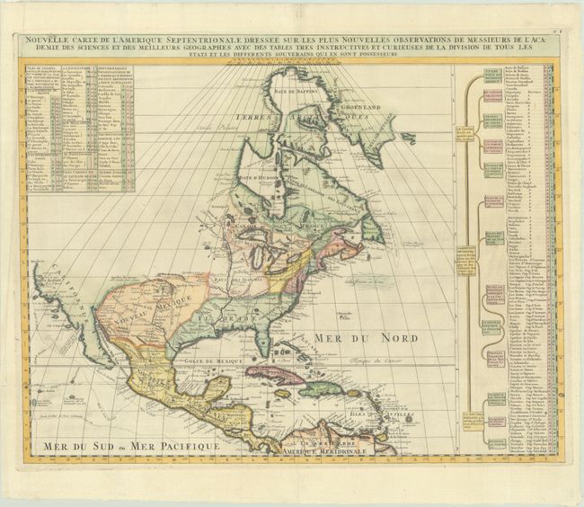
Subject: Colonial North America

Period: 1721 (published)

Publication: Atlas Historique, Tome I

Color: Hand Color

Size:
23.3 x 18.4 inches
59.2 x 46.7 cm
Download High Resolution Image
(or just click on image to launch the Zoom viewer)

This is Chatelain's re-engraved version of Delisle's foundation map of North America. The cartography is nearly identical to the Delisle map, with California returned to its peninsular position rather than as an island. Mendocin is the farthest northern point on California, and the northwest portion of the continent is left blank. The Great Lakes are well-defined, based on Coronelli. The Mississippi River valley is well developed with recent French settlements. A chart to the right lists the primary divisions of North America with colonial interests, native tribes, and towns.

References: Lowery #263; Phillips (Atlases) #579; Koeman, Cha 2, No. F.

Condition: A

A sharp impression, issued folding on a bright sheet with an elephant watermark and professional repairs to several tiny separations along the folds.

Estimate: $550 - $700

Sold for: $425

Closed on 6/18/2025

Closed