Subject: Western Africa
Period: 1780 (circa)
Publication: Atlas de Toutes les Parties Connues du Globe Terrestre
Color: Hand Color
Size:
12.4 x 8.3 inches
31.5 x 21.1 cm
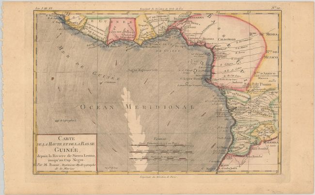
This nicely engraved map shows all of the Guinea coast and the kingdoms to its south, stretching from Cape Verga to Cape Negro in present-day Angola. The map locates many towns and villages, rivers, and coastal features. It extends to include Saint Helena and Ascension Island, the small volcanic islands discovered by Portugeuse explorers in the early 16th century. Arrows in the ocean indicate the directions of the currents.
Rigobert Bonne was an important French cartographer of the late 18th century. In 1773 he succeeded Jacques Bellin as the royal cartographer in the office of the Hydrographer at the Depot de la Marine. Working in his official capacity, Bonne compiled some of the most detailed and accurate maps of the period.
References:
Condition: B+
A crisp impression on a lightly toned sheet.