Subject: Africa
Period: 1696 (circa)
Publication:
Color: Hand Color
Size:
22.9 x 18.4 inches
58.2 x 46.7 cm
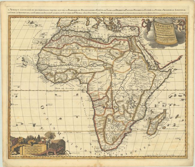
Gerard Valck was granted privilege to produce maps copied from Sanson/Jaillot in late 1695 and issued this map of Africa along with the other continents and the world to appeal to increasing demands in the French market for maps with French text. The map shows details typical of the late seventeenth century. The large rivers are marked and the Nile appears according to the ancient pattern, arising from two lakes located south of the equator. No tribal names appear in the south other than the Monomotapa kingdom. There are two islands of St. Helena, as so often appear in maps of this period. The title cartouche in the upper right corner consists of two cherubs holding a fringed blanket on which the title appears. At the lower left corner is a distance scale cartouche featuring a lion, an elephant, a leopard, a camel and a crocodile. An additional French title is in the top margin: "L'Afrique Distinguee en ses Principales Parties Scavoir la Barbarie, le Biledulgerid, l'Egypte..."
References: Betz #161; Norwich #49.
Condition: B+
A sharp impression on a bright sheet with a watermark of the initials "C S". There are some light, scattered stains in the bottom third of the image and a short centerfold separation at bottom that has been archivally repaired. Remnants of hinge tape on verso.