Catalog Archive
Auction 204, Lot 613

"Carte de la Partie Inferieure de l'Inde en deca du Gange, Contenant l'Isle de Ceylan, les Cotes de Malabar, et de Coromandel...", Bonne, Rigobert

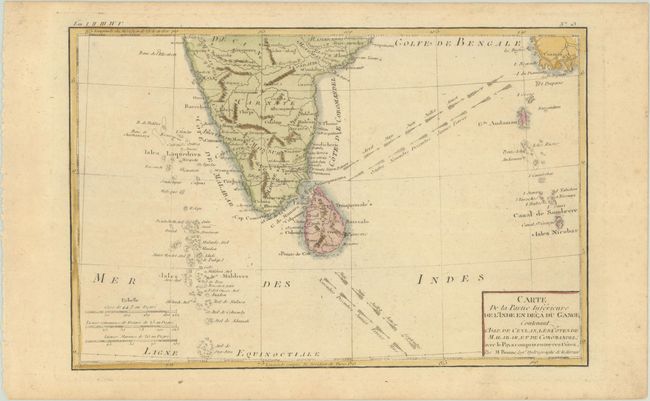
Subject: Southern India & Sri Lanka

Period: 1780 (circa)

Publication: Atlas de Toutes les Parties Connues du Globe Terrestre

Color: Hand Color

Size:
12.6 x 8.3 inches
32 x 21.1 cm
Download High Resolution Image
(or just click on image to launch the Zoom viewer)

Attractive map of southern India, Sri Lanka and the Maldives. The prevailing winds are shown between India and Mayanmar and marked with the months of the year.

Rigobert Bonne was an important French cartographer of the late 18th century. In 1773 he succeeded Jacques Bellin as the royal cartographer in the office of the Hydrographer at the Depot de la Marine. Working in his official capacity, Bonne compiled some of the most detailed and accurate maps of the period.

References: Gole (India) #83-2.3.

Condition: B+

A crisp impression with very light toning.

Estimate: $80 - $95

Sold for: $60

Closed on 6/18/2025

Archived